Posts

How Drones Help In Forest Surveying?

Image
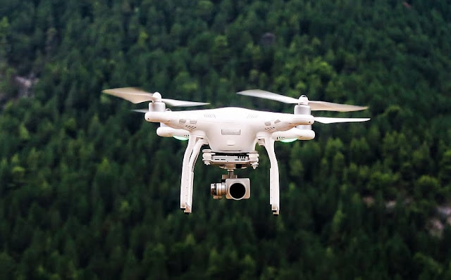
The world is moving fast! With technologies advancing at a fast phase along, drone technology has modernised various industries, and forest surveying is no exception. Drones like Ninja UAV Scout and DJI Air 2S provide a cost-effective and efficient solution for collecting crucial data in forested areas. In today’s blog, let’s tell you how drones are transforming forest surveying and contributing to enhanced conservation efforts. Aerial Imaging One of the key advantages of drones in forest surveying is their ability to capture high-resolution aerial imagery. Equipped with cameras and sensors, drones can fly over vast areas, capturing detailed images from different angles and elevations. This imagery provides valuable insights into forest health, tree density, species distribution, and overall ecosystem dynamics. However, make sure you hire drones from a reliable GIS Mapping company that offers drones for rental.This enables researchers and conservationists to monitor changes over ti

How Drone Surveying Services in Chennai Helps Industries?

Image
Have you ever seen aerial drones? Well, it's not a drone camera that you see in events or weddings. It's much more than that and is used for greater purposes. Yes! We are talking about drone surveying services. Over the years, drone surveying companies in Chennai have revolutionised the field of data collection and analysis. Drones like Ninja UAV and DJS Air 2S are increasingly being employed for surveying purposes due to their accuracy, efficiency, and cost-effectiveness. In this blog, we will delve into the advantages of using drones for surveying and how it is transforming various industries.  Advantages of Drone Surveying Services  Accuracy and Precision Aerial drones like Ninja UAV Lightweight Scout and DJS Air 2S are equipped with advanced sensors that capture high-resolution imagery that accurately maps the terrain and gathers precise data. This eliminates human errors and ensures reliable results. Time and Cost Efficiency Unlike traditional surveying methods, drone sur

Can GIS Mapping Assist With Land Measurements?

In the previous blog, we have learnt how GIS Mapping companies in Chennai are helping businesses. Today, we are going to know about how GIS Mapping services can help your land measurements. Whether you're a land seller or buyer or want to build something where you need accurate measurements. Mapping services are crucial for land measurements and help you buy risk-free lands for your personal or commercial purposes. Let’s see how GIS Mapping services in Chennai can help you. Accurate Land Measurement GIS mapping uses satellite imagery, aerial photography, and survey data to accurately measure land parcels. By overlaying these data sources onto a digital map, GIS software can calculate precise measurements, including area, perimeter, and boundaries. This eliminates the need for manual measurements, reducing errors and providing reliable information for landowners and potential land buyers. Parcel Identification It assigns unique identifiers to each land parcel on a digital map. Th

How To Unleash the Power of Geospatial Mapping?

Image
In today's data-driven world, geospatial mapping has emerged as a game-changer for businesses across industries. Leveraging the expertise of a geospatial mapping company can unlock a plethora of benefits, transforming the way businesses operate and make informed decisions. In today's blog, let's explore the relevance, usefulness, and interesting aspects of geospatia lmapping services in India, highlighting how they can propel your business towards unprecedented success. Accurate Insights for Smarter Decision-making Geospatial mapping services provide businesses with accurate and real-time insights into various spatial aspects, such as land use, infrastructure, demographics, and environmental conditions. By integrating these precise data sets into their decision-making processes, companies gain a competitive edge by making informed choices about market expansion, resource allocation, risk assessment, and infrastructure planning.   Optimised Operations and Efficiency

Why Drone Surveying Is Important For Businesses Like Yours?

Image
  Have you heard of Drone Surveying ? Do you know what it can bring to your business? Well, that's exactly what we delve deep into this blog. In today's fast-paced business world, staying ahead of the competition is crucial. One way to gain an edge is through the use of cutting-edge technology. When it comes to surveys and data collection, drone surveying in India has emerged as a game-changer for businesses across various industries. In this blog post, we will explore why drone surveying is essential for businesses like yours. Increased Efficiency and Accuracy For decades, businesses were using Traditional surveying methods but it was time-consuming and labour-intensive. Drone surveying, on the other hand, offers unparalleled efficiency and accuracy. Drones equipped with high-resolution cameras and advanced sensors can quickly capture detailed aerial imagery and collect precise data. This not only saves time but also minimises human error, ensuring the accuracy of the coll