Posts

Showing posts from September, 2023

How DGPS Surveys Are Performed in India? Precision of Geospatial Data Collection

Image
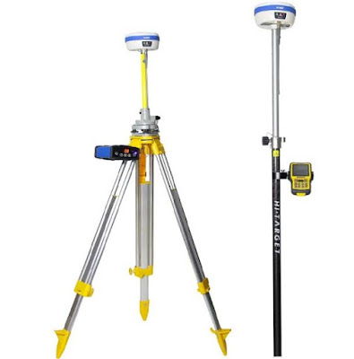
In the field of geospatial data collection, Differential Global Positioning System   DGPS surveys in India have become a vital technique for achieving accurate positioning and mapping. This blog explores how DGPS surveys are performed in India, highlighting the methods and technologies employed to ensure precise and reliable geospatial data. Understanding DGPS Surveys DGPS surveying companies in India utilize a network of reference stations to correct GPS signals, significantly enhancing the accuracy of positioning data. By comparing the GPS signals received at the reference stations with those received by a mobile receiver, errors caused by atmospheric disturbances and satellite clock discrepancies can be mitigated. This correction process allows for precise positioning measurements with sub-meter or centimeter-level accuracy. DGPS Surveying Process in India: In India, DGPS surveys are performed using the following steps: Establishing Control Points The first step is to

Choose The Best DGPS Survey In India - Here’s How?

Image
DGPS survey technologies have improved many aspects of surveying in the modern age. For instance, it is now possible for users to measure land areas and assess infrastructure in a matter of minutes or hours, as opposed to weeks or months handling traditional methods. One such technology on offer is the Differential Global Positioning System DGPS survey in India offered by MAPe IT solutions; an Indian based GISMapping company focused on advanced digital indicators used in geospatial replacement applications and data collection projects. This blog examines the advantages this service brings local business ventures when applied to their project needs. DGP survey offers several benefits over traditional GPS surveys: Increased accuracy DGPS uses a network of base stations to provide correction signals, which significantly enhances the accuracy of GPS measurements. It reduces errors caused by atmospheric conditions, satellite clock deviations, and signal delays. Improved reliabil

Orthophoto Mapping: Unveiling the Power of Georeferenced Imagery with MAPe IT Solutions

 In the realm of surveying and mapping, ortho photomapping has emerged as a powerful technique for capturing accurate, georeferenced representations of the Earth's surface. This blog explores what ortho photomapping is and how MAPe IT Solutions can assist you in harnessing its potential for your projects. Understanding Ortho Mapping Ortho Mapping involves the creation of orthophotos, which are aerial or satellite images that have been corrected to remove distortions caused by terrain relief or camera tilt. These images are then precisely aligned with a geospatial reference system, resulting in a high-resolution, geometrically accurate representation of the Earth's surface. Orthophotos serve as a valuable tool for various applications in urban planning, land management, infrastructure development, and environmental monitoring. The Benefits of Ortho Mapping Ortho photomapping offers several distinct advantages over traditional methods. Accurate Measurements By corre

How Drones Help In Forest Surveying?

Image
The world is moving fast! With technologies advancing at a fast phase along, drone technology has modernised various industries, and forest surveying is no exception. Drones like Ninja UAV Scout and DJI Air 2S provide a cost-effective and efficient solution for collecting crucial data in forested areas. In today’s blog, let’s tell you how drones are transforming forest surveying and contributing to enhanced conservation efforts. Aerial Imaging One of the key advantages of drones in forest surveying is their ability to capture high-resolution aerial imagery. Equipped with cameras and sensors, drones can fly over vast areas, capturing detailed images from different angles and elevations. This imagery provides valuable insights into forest health, tree density, species distribution, and overall ecosystem dynamics. However, make sure you hire drones from a reliable GIS Mapping company that offers drones for rental.This enables researchers and conservationists to monitor changes over ti