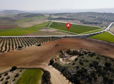
Orthophoto Mapping: Unveiling the Power of Georeferenced Imagery with MAPe IT Solutions
In the realm of surveying and mapping, ortho photomapping has emerged as a powerful technique for capturing accurate, georeferenced representations of the Earth's surface. This blog explores what ortho photomapping is and how MAPe IT Solutions can assist you in harnessing its potential for your projects.
Understanding Ortho
Mapping
Ortho Mapping involves the creation of orthophotos, which are aerial or satellite images that have been corrected to remove distortions caused by terrain relief or camera tilt. These images are then precisely aligned with a geospatial reference system, resulting in a high-resolution, geometrically accurate representation of the Earth's surface. Orthophotos serve as a valuable tool for various applications in urban planning, land management, infrastructure development, and environmental monitoring.
The Benefits of Ortho
Mapping
Ortho photomapping offers several distinct advantages over traditional methods.
Accurate Measurements
By correcting distortions and aligning the images with a coordinate system, orthophotos enable precise measurements of distances, areas, and features on the Earth's surface. This accuracy is crucial for tasks such as land surveys, infrastructure design, and environmental impact assessments.
Georeferencing
Capabilities
The integration of orthophotos into a geospatial reference system enables easy integration with other spatial data layers. This facilitates spatial analysis, data integration, and overlaying of different datasets for comprehensive decision-making.
Visual Clarity
Orthophotos provide a clear and detailed view of the Earth's surface from above. This level of detail aids in identifying features like buildings, roads, vegetation cover, and water bodies accurately. It enhances visual interpretation and assists in making informed decisions during planning and design processes.
How MAPe IT Solutions
Can Assist You?
MAPe IT Solutions specialises in providing comprehensive ortho photomapping services tailored to your specific needs. Here's how we can help:
High-Quality Data
Acquisition
Leveraging advanced aerial or satellite imagery technologies, we capture high-resolution images of your project area, ensuring superior quality data for accurate orthophoto mapping.
Georeferencing
Expertise
Our skilled team employs precise georeferencing techniques to align orthophotos with the appropriate coordinate system, ensuring accurate spatial reference and compatibility with other geospatial data layers.
Customised Solutions
We understand that every project is unique. Our team collaborates closely with clients to understand their requirements and deliver customised ortho photomapping solutions that meet their specific objectives.
Cutting-Edge Software
and Tools
MAPe IT Solutions utilises state-of-the-art CAD software and image processing tools to ensure efficient processing, analysis, and delivery of orthophotos. This enables us to provide you with timely and accurate results.
Orthophoto mapping has become an indispensable tool in surveying and mapping applications due to its accuracy, georeferencing capabilities, and visual clarity. With MAPe IT Solutions' expertise in this field, you can harness the power of highly accurate, georeferenced imagery for your projects. From data acquisition to precise georeferencing, our customised solutions aim to meet your specific requirements efficiently.
For orthophoto mapping,
Geospatial mapping in Chennai, India and across the globe, reach out to
MAPe IT Solutions at (+91) 9443338087 today.


Comments
Post a Comment