How Drones Help In Forest Surveying?
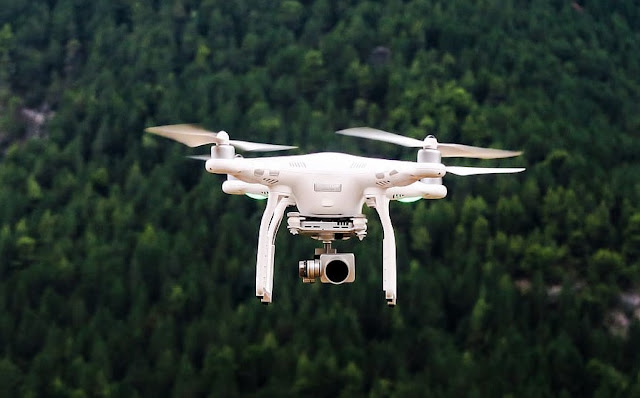
The world is moving fast! With technologies advancing at a fast phase along, drone technology has modernised various industries, and forest surveying is no exception. Drones like Ninja UAV Scout and DJI Air 2S provide a cost-effective and efficient solution for collecting crucial data in forested areas. In today’s blog, let’s tell you how drones are transforming forest surveying and contributing to enhanced conservation efforts.
Aerial Imaging
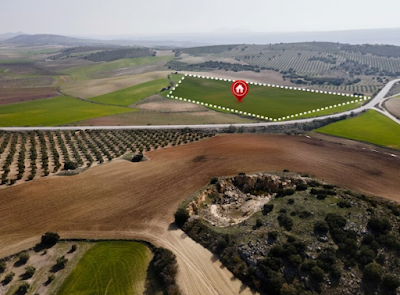
One of the key advantages of drones in forest surveying is their ability to capture high-resolution aerial imagery. Equipped with cameras and sensors, drones can fly over vast areas, capturing detailed images from different angles and elevations. This imagery provides valuable insights into forest health, tree density, species distribution, and overall ecosystem dynamics. However, make sure you hire drones from a reliable GIS Mapping company that offers drones for rental.This enables researchers and conservationists to monitor changes over time, identify potential threats such as disease outbreaks or illegal logging, and plan effective conservation strategies accordingly.
Efficient Mapping and Monitoring
Drones equipped with LightDetection and Ranging (LiDAR) sensors revolutionise forest mapping and monitoring. LiDAR technology uses laser beams to measure distances between the drone and the ground, creating highly accurate 3D models of the terrain below. In forests, LiDAR helps map topography, identify elevation changes, measure tree heights, and capture detailed information about vegetation structure.This data is critical for assessing biodiversity, understanding habitat connectivity, and planning forest management activities such as selective logging or reforestation efforts.
Rapid Data Collection
Traditionally, collecting data in dense forests was time-consuming and often dangerous for field researchers. Drones overcome these challenges by significantly reducing data collection time while providing a safe alternative to ground-based surveys. Drones can cover large areas quickly, collecting vast amounts of data in a fraction of the time it would take using traditional methods. This accelerated data collection process allows for more frequent assessments, enabling real-time monitoring of forest conditions and facilitating rapid response to any emerging threats or disturbances.
Enhanced Accuracy and Efficiency
Drones equipped with advanced sensors, such as multispectral or thermal cameras, enhance the accuracy and efficiency of forest surveys. Multispectral cameras capture data beyond visible light, enabling the identification of specific vegetation types, stress levels, or invasive species. Thermal cameras help detect variations in temperature, which can indicate areas prone to wildfires or the presence of wildlife. By integrating these sensors with drone technology, forest surveyors can obtain highly precise and comprehensive data that helps in making informed decisions for conservation planning.
The integration of drones in forest surveying has opened up new possibilities for understanding and managing our precious forest ecosystems. From aerial imaging to efficient GIS mapping and rapid data collection, drones offer a cost-effective and safe solution for gathering vital information crucial for conservation efforts.


Comments
Post a Comment